Author: Brady Dorman (page 19 of 22)

Metro Area Transit

Metro Area Transit

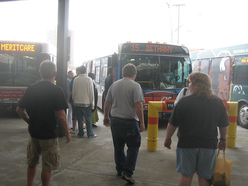
Fargo and Moorhead’s joint bus system, Metro Area Transit, was the first system on which I was a regular rider. For many students, college is their first experience with public transportation, whether for convenience on campus or for reliance due to not having a car. Though I wasn’t such a transit enthusiast back then as I am now, I certainly wasn’t against it and wanted to make the best of it and judge for myself how convenient and easy or inconvenient and slow it actually was. I also did not (and still do not) have a car, so before making friends it was really my only means of getting around town. Since campus is relatively small, I pretty much just walked or biked to class and my on campus job, as my dorm was only about a block from the hub of academic buildings along Albrecht Blvd.

Two circulator routes ran through campus, Route 31 On-Campus Circulator every 15 minutes, and Route 32 Near-Campus Circulator, serving University Village and other apartments nearby every 30 minutes. I would occasionally ride one of these a few blocks to or from class if it happened to be coming by at the right time. A new night circulator, Route 35 started during spring semester 2008, running between campus and University Village from 8 – 10:07pm.

My fall semester (2006) I would occasionally ride the bus out to Target or West Acres mall to run errands on the weekends. It would require a transfer downtown at the GTC so all together it probably took half an hour each way – not bad, but certainly longer than driving. Route 15 serves West Acres from downtown and was always pretty busy. One time I recall standing room only on the ride back with nearly 50 passengers on board according to a fellow rider’s count – quite crowded for a 30-foot low floor bus.

In the spring I had class at NDSU Downtown twice a week so I began taking the bus regularly, as most of my classmates did too. Route 13 connects campus to downtown ad the GTC. Presumably after NDSU Downtown opened, MAT added 13B to provide more frequent service between campus and downtown on school days. While 13A runs along the regular route, 13B does not run as far north so its a quicker trip back to campus. The two routes alternate, each with 30 minute headways, to provide 15 minute service to downtown and back during the day.
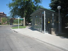
NDSU bus shelterEarlier this year MAT expanded the Memorial Union bus shelter on campus and added a bus locator display, utilizing on-board GPS to track the whereabouts of 13A and 13B. With a very simple time schedule, I’m not sure this was necessary, but with new buses it probably wasn’t a major expense to implement and has implications for more trackers around the metro that could improve legibility and ease-of-use for the whole system. The tracker should be nice in the winter when buses typically run a few minutes behind schedule due to road conditions and inclement weather.

With the growth of NDSU’s downtown campus, MAT is planning for additional bus service between campuses. Especially for business students who do not have to essentially live at studio like architecture students, this should be a convenient means of getting between classes. Evidently no student parking will be provided at either of the two new campus buildings, which is a concern of architecture students who frequently will be working there all hours of the night when buses do not run.

Generally Metro Area Transit is a well run transit system with 22 routes serving Fargo, Moorhead, and West Fargo. I always had a good experience riding, with friendly drivers, well maintained buses, and sufficient schedule/route information provided.

When I was back in the area last weekend, I stopped by the GTC to get some pictures and even rode a route for a few blocks (my old Bison Card still grants me free rides). It was fun to check it out again, especially now that I have a better understanding of the ins and outs of transit operation as a driver for CyRide. MAT is a decent system that is certainly better and more adaptive than Cedar Rapids Transit and could probably rival CyRide if it had the same resources and ridership demand.

Check out my MAT bus pictures on Flickr.
More info on MAT’s website at www.matbus.com.
Fargo Revisited

Last weekend (August 8-11) I traveled to Fargo, North Dakota, for my friend’s wedding. I attended my first year of college at North Dakota State in Fargo from 2005 to 2006, so it was nice to get back and see my old friends and the city that was my first home away from home. I was sure to make time to look around a bit and see what has changed. The city was just as I remembered it, but I quickly realized the character and qualities of Fargo that I had come to admire, especially in the older neighborhoods and downtown. It was sort of like coming home.

Fargo’s older areas – within a mile or two radius of downtown – have aged nicely. Matured tree canopies have formed over residential streets, turning these axes of movement into spaces of their own. Mostly modest homes are well maintained. Residential streets flow harmoniously into downtown – with large yet unintrusive MeritCare hospital on the north end and beautifully simple Island Park to the south. There are no significant physical or psychological barriers surrounding downtown so there is good pedestrian connectivity between downtown and nearby neighborhoods.

I visited downtown briefly the morning before I left town. I parked on the north end of Broadway near the old Great Northern depot and walked down to the GTC and then stopped by NDSU Downtown. Walking down the sidewalk I could sense the liveliness around me. Despite massive suburban growth out west and south, downtown is still successful and retains the community’s heart.

Two years ago I scoffed off Fargo’s downtown as minimal or less impressive than that of my hometown Cedar Rapids simply because it had less of a “big city” feel – and big city skyline – that I perceived back home. Of course now I realize human scale design, pedestrian-friendliness, and 24-7 vibrancy are the traits actually good urban downtowns, not superficial towers that likely contribute little to sidewalk activity. Even before the flood that devoured Cedar Rapids’ downtown, I believe Fargo’s downtown is still a more dynamic city center. While downtown Cedar Rapids is/was certainly a bigger employment center, most of those jobs are in the 9-5 office crowd. Fargo’s downtown seems to be much more diverse with a more significant retail and restaurant scene. They also didn’t tear down as many of their older buildings that give downtowns their historic character and human-scale.

13th Ave S, Fargo - West Fargo, ND

Away from downtown and the older neighborhoods, Fargo is booming to the south and west, furthering suburban sprawl far out in to the plains. 13th Ave S, west of I-29, and extending into the city limits of West Fargo is the metro’s principle shopping corridor. It is big box central, a landscape of asphalt and low rise retailers. For over two miles, the roadway is characterized by heavy traffic, cheap buildings, and very few trees. I actually didn’t go down the whole way while I was there, but my guess is that much has remained the same.

Woodhaven Plaza

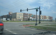
There are signs of some more urban-minded development on the outskirts, like Woodhaven Plaza at 40th Ave S and 42nd Street S, a three-story, mixed facade building with commercial space and upper residential units for sale. Somewhat awkwardly, an enclosed glass walkway is juxtaposed against the front of the ground level storefronts, for the winter months. Even though this development is an improvement over the monotonous strip mall or big box, it is still includes a sea of parking, is not built up to the sidewalk, and is surrounded by typical suburban subdivisions. So while these developments make an effort to be more urban and amenable to pedestrians, the fact is most people will still arrive by car because it is still more convenient than alternative modes.

All in all I had a good time on my visit to Fargo. Its a nice community that I enjoyed being a part of. Read more about NDSU and Metro Area Transit in my following posts.

Reshaping Sioux Falls

The Sioux Falls Argus Leader ran a story last Sunday (July 20) on how residents and city planners are making changes in response to rising gasoline prices in the booming community. According to the story, “Sioux Falls residents increasingly are using bikes and scooters, catching buses and moving closer to their jobs as reality sinks in.”  It cites several Sioux Fallsians that parked the SUV for their bike, scooter, or bus pass instead, including Miss South Dakota USA 1978, Nadene Oppold, who has no car and says she doesn’t want one.  The article also presents New Urbanism and the idea of a community less auto-oriented and makes alternative transportation easier and more convenient.

Sioux Falls has been growing at a tremendous rate for the past 10-15 years, adding over 3000 new residents just since 2007.  The city limits have expanded also, with the majority of development suburban and auto-centric, abandoning Sioux Falls’ historic street grid and characterizing the whole city as one large suburb.  Not to say development in peer metros are any less suburban; simply the rate at which Sioux Falls is expanding, and all within the center city’s limits, authenticates the “one big suburb” depiction.  The fact that a significant and growing portion of the City proper has been developed in post-war low density, single-use fashion, its identity is no longer the downtown but in the sprawling expanse of monotonous subdivisions and “upscale” strip centers with ample parking.

Sioux Falls city planners are trying to change that image by changing behaviors and modernizing land-use rules. The 25 year-old zoning ordinance is being overhauled, “with an eye toward more green space and less concrete” and ultimately to make mixed-use, more compact, efficient development a bigger part of the city’s future growth.

Earlier this year the Planning Department conducted a “visual listening” survey called Shape Sioux Falls to determine a community-wide vision for land-use standards that will be integrated into the updated zoning regulations. I came across this survey a while ago and found it particularly interesting. It was a collection of over 150 images of examples of all the general land use categories (commercial, industrial, residential, etc.) of varying aesthetic quality, to be rated on a scale of -5 to +5 on favorability for Sioux Falls. About 1500 community members participated and results show preference for human-scale, vibrant streets; plenty of green space, and less design emphasis on automobile use. This was a good format for identifying and analyzing what the community values in new and existing development in the city.

While Sioux Falls is making progress, the future success of these initiatives will ultimately depend on the attitude of residents. While high gas prices have become more than just a burden, now an economical hardship for many, I believe this will lead to a positive shift in the way we develop and interact in our urban – and suburban – environments. Thanks to high fuel costs, transit ridership is up all around the country and people are consuming fewer resources and making more sustainable lifestyle choices. It’s good to see Sioux Falls adapting to these changes for a better city tomorrow.

Links
> “Gas prices change way Sioux Falls plans” Argus Leader
> Sioux Falls Planning Department
> Shape Sioux Falls Initiative

Downtown transfer returns

Cedar Rapids Transit will move it’s temporary transfer site Monday back to downtown at park-and-ride lots along the riverfront at 12th Avenue and 2nd Street SE. The current transfer site, set up at the corner of 4th Avenue and 12th Street SE when service resumed after the flood, is about ten blocks east of the downtown Ground Transportation Center, consequently causing on-time issues for west side routes. Routes serving the east side have been arriving at the endpoint about five minutes ahead of time while west side routes have been running behind schedule in the afternoons when ridership appears to be the heaviest. The return to downtown should allow buses to more easily maintain the regular schedule. This new temporary site is within a few blocks of the future intermodal transportation facility that is planned to house a new bus transfer station. Transit service continues fare free for now with hourly headways on all routes.

New courthouse on fast track

Cedar Rapids’ planned new courthouse has been bumped up on the priority list for construction by the Judicial Conference of the U.S. Courts Executive Committee, in lieu of severe flood damage to the existing 77 year-old courthouse. Senators Tom Harkin and Chuck Grassley have been working the past few weeks to get the courthouse moved up, which has been delayed for fifteen years while other courthouse projects have been expedited. This is certainly good news for Cedar Rapids and downtown. The 8-story building that will be elevated above the 500 year flood plane will enhance the city’s skyline and be a very visible sign of the city’s triumph over the flood. According to the Gazette, construction could begin as early as next year.

IC Jazz Festival

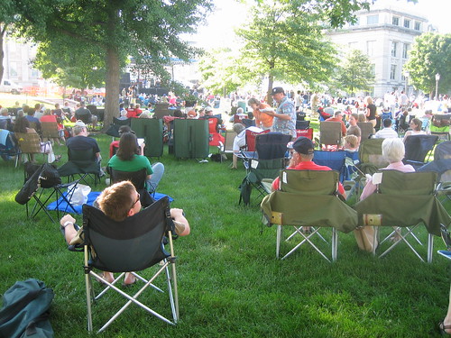
The 18th annual Iowa City Jazz Festival was held this past Independence Day weekend in downtown Iowa City on the Pentacrest, the heart of the University of Iowa campus. This is one event I look forward to each summer – great music, great food, a great community of people. Cedar Rapids jazz radio station KCCK did a live broadcast of performances from the three day festival, simulcasted on Iowa Public Radio and Omaha Public Radio.

My father George works at KCCK so I have been attending the festival on and off for many years.  Also in recent years my brother Daniel (of The Soundhole recording studio) has been doing production work for the broadcast.  So between both of them I’ve gotten an interesting back stage look into the festival.  But, honestly what I look forward to most is not the music or the vendors, but the gathering of people and the collective delight of community.

Check out all my photos on Flickr from the Iowa City Jazz Festival.

Life in Radiant City

I recently watched Gary Burns and Jim Brown’s “Radiant City” documentary on suburban sprawl. Chronicling the Moss family’s move to suburbia from inner-city Calgary, it is a critical look at the social and cultural aspects that have come with the growth of suburban “communities” in North America since the end of World War II.

Aside from periodic commentary from the filmmakers themselves and a host of guest experts, most of the film was members of the Moss family describing their daily routines and problems in suburbia and occasional scenes of the family interacting as normal. Evan Moss and his son are cynical about their new community, while Ann, the mom, tenaciously hopes that the community feel will come, focusing on the good and clearly resentful of her husband and son’s complaining.

The film is less about the environmental and ecological impacts of sprawl, but about the social implications of the suburban lifestyle. It details how suburban “communities” are monoculture and by that alone, unsustainable. Suburbia is developed by the masses so people of roughly the same age move in at the same time, have children around the same time – creating a temporary demand for schools, then grow old at the same time, becoming trapped or forced to leave because they either can no longer driver or required special services.

“Radiant City” is not a data-intensive documentary, nor is it an absolute doomsday lecture. It is, however, an intriguing new look into life in the suburbs and the shortcomings of the American dream, or in this case, the Canadian dream. It is certain to give viewers a new perspective and invoke a thoughtful dialogue on the burbs. Visit their website at www.radiantcitymovie.com.

Post-flood transit, clean up begins

Transit service resumed today after being suspended since Thursday due to the historic flooding that has occurred in Cedar Rapids and the midwest. Since the GTC, about a block from the river, was right in the middle of the flood zone, a temporary on-street transfer site was set up at 4th Avenue and 12th Street SE. No revised maps or schedules have been made available yet, but additional transit staff were available at the transfer point to assist passengers. Only one bus was running on each route so service was hourly all day.

I am working with the Veterans Memorial Commission this summer, which takes care of the Veterans Memorial Building on Mays Island, which houses city hall offices. The basement and mezzanine levels were completely submerged by flood water pushed in from the attached underground parking garage. The first floor also had about two feet of standing water, completely ruining the auditorium floor and numerous artifacts in the Spanish American War Memorial Room that houses the VMC office.

I was back to work Tuesday, mostly picking up sandbags and debris at the police station, library, and public works as we aren’t able to do much work in City Hall until the water goes down. Today the downtown bridges were reopened to traffic and downtown was alive, getting right to work on cleaning up. I’ve heard it could take weeks to get power back to downtown so it will certainly be along time until it is back to normal. My hope is that downtown can comeback bigger and better than it was before. While the flood will inevitable hurt small shops and businesses the most, it appears the extensive damage could expedite some large projects planned for downtown.

According to a June 18, Gazette article, Senators Tom Harkin and Chuck Grassley want the federal government to move ahead with construction of the planned new federal courthouse, which has been continuously delayed for the past fifteen years, instead of spending time and money on repairs to the current facility which would be inadequate anyway. This seems like a sensible idea and then the current courthouse could be renovated right away into mixed-use as is planned by the City of Cedar Rapids when it is transferred ownership in exchanged for the land slated for the new courthouse at 8th Ave SE between the river and 2nd Street. The site will of course be elevated so the new courthouse will be above the 500 year flood plane.

Another project that could become even more of a priority is the planned intermodal transportation facility which has been changed a number of times over the past five to ten years of initial planning. Now slated for 3rd Street SE around 9th Ave SE, the facility would include a parking garage to replace the First Street Parkade along the riverfront that has reached the end of its useful lifetime. Small repairs and patches have kept it open in recent years but according to some parking guys I was working with on Tuesday, the flood waters more than likely put it in disrepair. Personally I don’t think downtown needs another parking garage and that there is plenty of parking already, but it’d be good to see this and other projects move forward.

Transit buses used for jail evacuation

Click above for Youtube video of bus evacuation.

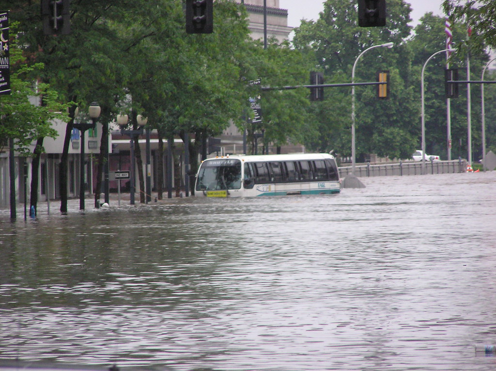
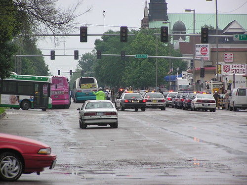
As all regular transit service was suspended in Cedar Rapids, city buses were used to transport evacuated inmates from the Linn County Jail to other facilities Thursday morning. According to the Gazette, more than a dozen buses were lined up along 3rd Ave SE between 6th and 8th streets, while at least two buses plowed through the water, 4-5 feet deep in some locations from Mays Island to the transfer site to other buses on 3rd Ave.

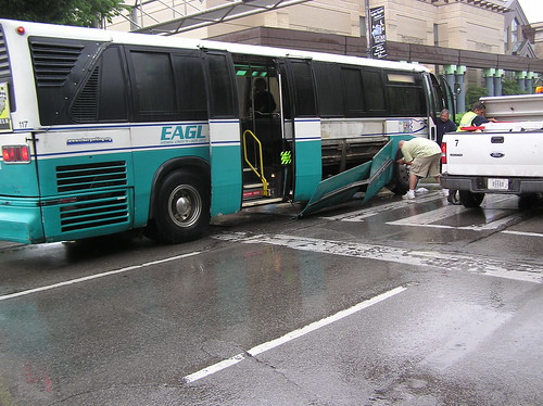
Some side panels were removed from the bus to prevent the water pressure from rolling the bus. Some that were not removed were literally falling off afterwords. According to a KCRG.com younewstv report, the buses began to float toward the curb by Smulekoff’s at 3rd Ave and 1st Street, so the doors were opened to let in water and get the buses back down.

Todd from the Gazette has some great images on Flickr (eibbtoddb) and a Youtube video you can link to above. Below are a few of Todd’s photos:

Cedar Rapids bus driving through deep water on 3rd Ave SE transporting inmates from evacuated Linn County Jail.

Staging area on 3rd Ave and 8th Street SE for inmates to transfer to other buses.

Side panels falling off bus after driving through window-deep water.

This flooding is unprecedented for Cedar Rapids, devastated thousands of homes and businesses. Over 400 blocks of the city including nearly every major building in downtown Cedar Rapids is currently under water. The outpouring of support by volunteers and neighbors lending a helping hand is a testament to the great community of Cedar Rapids and all of Iowa. It will be a long summer cleaning up and getting back to normal.

Record flooding in Cedar Rapids

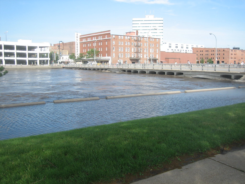
The Cedar River has reached record levels in the city. I am working with the Cedar Rapids Veterans Memorial / City Hall maintenance department for the summer and got some photos of the flooding today downtown. Several streets around the river and near downtown were under water today with more expected by tomorrow. As of this evening all downtown bridges were closed, leaving Interstate 380 as the only river crossing in the city.

A number of bus routes had to be rerouted in response to street and bridge closures today. From what I heard there were no official detour routes and drivers were simply going where ever to try to maintain service. Towards the afternoon, west side routes had to use I-380 to cross the Cedar River to the GTC as 1st Avenue West was underwater due to the storm sewer backing up. It has been announced that transit service will be suspended through at least Saturday. Some buses will be used to assist transporting volunteers and evacuees.

Older posts Newer posts

© 2022 URBAN THINKING

Theme by Anders NorenUp ↑